Things to do in Northeast
Things to do in Northeast
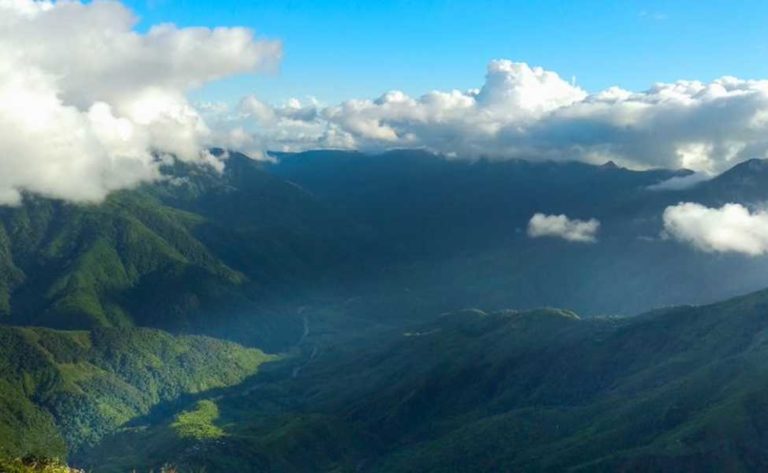
The Northeastern of India, sometimes known as the “country of the seven sisters,” is an intriguing region with magical boundaries. The region, which is home to 38.5 million people—or 4% of India’s population—and spans 2.55 lakh square kilometers—about 8% of the nation’s land—is bordered by China to the north, Bangladesh to the west, and Myanmar to the south and east. Only the 22 km Siliguri corridor, sometimes known as the “chicken’s neck” in West Bengal, connects this area to the rest of the country’s main landmass. The states in the area are: Arunachal Pradesh
Assam
Manipur
Meghalaya
Mizoram
Nagaland
Sikkim
Tripura
The region’s spectacular and amazing regional, geographical, and multiculturalism rivals its lush hills and winding rivers. The Brahmaputra, Barak, and Imphal valleys, as well as other flat areas and hills, make up the remaining two thirds of the region. This ethnically varied and diversified area is home to 192 languages and 209 tribes. The complex society of India’s melting pot is the result of the fusion and dissolving of numerous ethnicities and cultures. The seven States are currently administratively organised into 72 districts, 412 subdivisions, and 41240 villages. Commercially, the province is abundant in “TOT” environmental assets (Tea, Oil, and Timber). With the capacity to produce 50,000 MW of hydroelectricity, more than 30 billion cubic metres of natural gas, and a plentiful supply of fossil fuels, it is unquestionably a juggernaut. In this area, nature has been at its most benevolent; notice the beautiful scenery, the vibrant dawn and evening, and the lush vegetation. It is a gene pool with a rich biodiversity as well. The unspoilt ecology and beautiful splendour of the Northeast are well renowned. People coexist peacefully with nature. Their artwork and paintings do a great job of capturing this balance between man and environment. People coexist peacefully with nature. Their artwork and paintings do a great job of capturing this balance between man and environment. The North Easterners are extremely talented in the fields of aesthetic appeal and fine arts, such as painting. The plants and animals of a place are determined by its geographic circumstances, including its latitude and longitude, physical characteristics, particularly its height, soil, and weather conditions.
Travel Guides
Things to do in Northeast
KAZIRANGA NATIONAL PARK

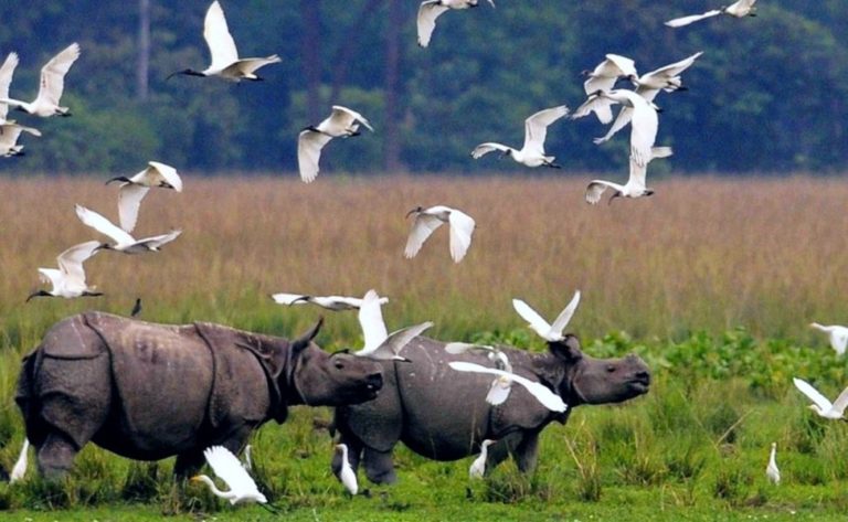
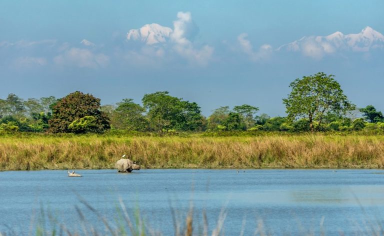
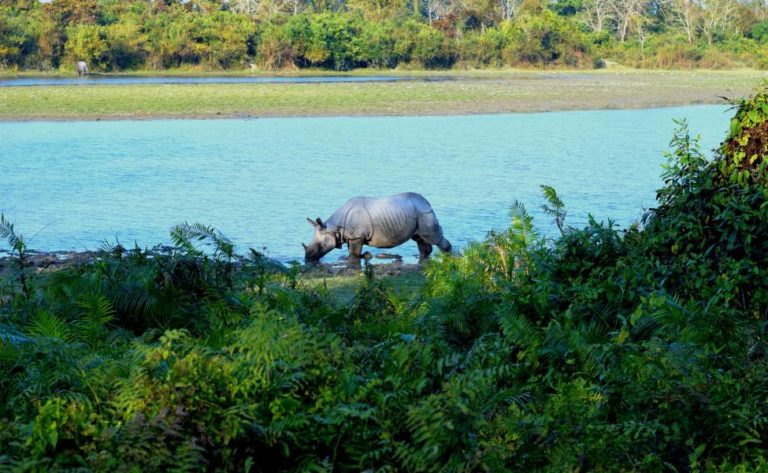
A world-class UNESCO site in Assam, Kaziranga National Park was created in 1908 and has a total size of 430 km2. It is well recognised for housing two-thirds of the big one-horned rhinoceroses in the world. Not only that, but it’s a vibrant and beautiful Tiger Reserve with a unique and significant place on India’s wildlife map. This preserve, known as the “Serengeti of the East,” is equipped with a thriving and varied range of geological features, making it a fantastic location to see endangered species like tigers and great one-horned rhinoceroses. Kaziranga is well-known for its diverse wildlife population, lush greenery, and prominent conservation projects. Due to population growth, the national park was designated as a tiger reserve in 2006; it is one of the few places in the world where tiger populations have increased rather than declined. Along with tigers and rhinos, BirdLife International has designated the park as an Important Bird Area due to the large population of black-necked storks, Asian Openbills, white-fronted geese, Baer’s pochard duck, ferruginous ducks, and other birds that migrate to the park every summer. The park’s fame has slowly increased over the years due to its amazing wildlife conservation initiatives, rendering it one of the most popular and adored tourist destinations in Assam. Among the most thriving trees you can see on a safari in the park are the Indian gooseberry, elephant apple, cotton tree, and kumbhi. On this journey, which includes alluvial savannas, wetlands, and tropical woods, you will sense at one with nature. It’s a long way from the nearby bustling city of Nagaon, but it’s the ideal place to stop for a snack while cruising down the Hooghly, Lower Ganges, or Brahmaputra rivers. You will be in enamored of Kaziranga National Park from the moment you land and wish to return time and time again, regardless of the river tour you select. With a range of recreational opportunities to enjoy, this park in Assam, which has a total area of over 430 sq miles, is great for trips with family traditions.
TAWANG MONASTERY

In compliance with the desires of the 5th Dalai Lama, Nagwang Lobsang Gyatso, the Mera Lama Lodre Gyatso constructed the Tawang Monastery. The Gelugpa cult’s abbey is the biggest Buddhist institution in India. It is connected to Lhasa’s Drepung Monastery. Tawang, which translates to “Chosen Horse,” Galden Namgey Lhatse, a Tibetan name that translates to “a truthful name inside a heavenly wonderland in a lovely night,” is yet alternative name for it. North-eastern India’s Tawang, a little hamlet tucked away in the eastern Himalayas, is well-known for its 400-year-old temple complex. Among the largest Buddhist monasteries in India, this abbey serves as a major destination for pilgrims who practise Buddhism. In addition to its religious significance, Tawang is well known for its breathtaking scenic scenery, which draws and charms tourists. Tawang’s history is a mystery. Tibet used to have authority over Tawang. The McMahon Line, that defined Tibet’s and British India’s shared border in the Assam Himalaya region, was agreed by the 1914 Constituent Assembly. By way of this deal, Tibet gave the British control over numerous hundred square miles of its land, especially Tawang. China refused to recognise the accord. The Monpa people of this kingdom eventually embraced Buddhism over the following centuries, and in the 17th century the mesmerising Galden Namgey Lhatse Monastery, which is affiliated with the Gelug classroom of Mahayana Buddhism and translates as “celestial paradise in a clear night,” was constructed in the town of Tawang at the request of His Holiness the 5th Dalai Lama, Ngawang Lobsang Gyatso. Since then, the area’s landscape has shone even more brilliantly as a hub for in-depth Buddhist research and rich cultural traditions. The Tawang Monastery is located about two kilometres from the township. The Tawang Ganden Namgyal Lhatse Monastery, which translates to “the heavenly bodies paradise of divine site selected by the horse,” is the second-largest and oldest in all of Asia. It was established in 1680–1681 by Merag Lodroe Gyamtso. He received an artwork of the goddess Palden Lhamo from the Dalai Lama to hang in the monastery. The sanctum is dominated by the 8 m tall gliding statue of Lord Buddha. A stirring image is created by the enormous whirling prayer wheels, valuable thangkas, the droning of the monks as they chant, and the flashing butter lamps. The Tawang Monastery houses a residence for the monks, as well as a library, a gallery, and a primary school. The most well-known monastery in Arunachal Pradesh is this one. The Gaden Namgyal Lhatse, another name for Tawang Monastery, is located on a sharp hilltop at a height of roughly 10,000 feet. Merak Lama Lodre Gyamtso founded the well-known Tawang Monastery, which is a well-liked tourist destination. It provides an impressive and beautiful view of the Tawang – Chu valley. Tawang Monastery, also known as Galden Namgyal Lhatse, is amongst the most revered locations for Mahayana Buddhism. Tawang Monastery, which is a part of the Gelugpa branch of Buddhism, is the location of 17 gompas and is residence to more than 300 monks. Tawang Monastery, known for its 16th-century craftsmanship, provides a tranquil perspective of the Himalayan region. Drawings and paintings of Bodhisattvas, a silver silk casket devoted to the divinity Shri Devi, and a variety of other pieces of art are some of the well-known attractions at Tawang Monastery. Throughout the Losar festival is the best time to visit Tawang Monastery.
LIVING ROOT BRIDGE

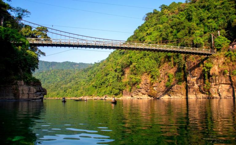
Extraordinary man-made wonders of nature can be found in Meghalaya’s profound tropical jungle, which is cloaked in fog and rain for a majority of the year. Ingenious Khasi tribe people have taught what are known as “living root bridges” to sprout from the roots of ancient rubber trees that are indigenous to the northeast. The root bridges offer a reliable replacement for timber bridges, which deteriorate and are damaged over the course of the protracted monsoon months. A new root connection needs around 15 years to build up enough strength to withstand the weight of individuals using it. It will, nevertheless, develop and become even stronger with time. However no one is certain, several of the bridges are thought to be hundreds of years old. Their intricate root systems have an almost uncanny appearance and would not be out of place in a fantastical setting. Bridge made of living tree roots in Nongriat Village Growing tree root footbridge made at Nongriat Settlement using the fig tree’s roots. Images by Amos Chapple / Getty Remarkable man-made phenomena of nature can be found in Meghalaya’s deep tropical jungle, which is cloaked in fog and rain for a majority of the year. Ingenious Khasi tribe people have taught what are known as “living root bridges” to sprout from the roots of prehistoric rubber trees that are indigenous to the northeast. The root bridges offer a reliable replacement for timber bridges, which deteriorate and are destroyed over the course of the protracted monsoon seasons. The Living Root Bridges: A Brief Overview A new root bridge needs around 15 years to develop sturdy enough to support the weight of humans using it. It will, nevertheless, develop and become even stronger with time. However no one is certain, several of the bridges are thought to be hundreds of years old. Their intricate root systems have an almost uncanny appearance and would not be out of place in a fantastical setting. The “double-decker” root bridge, which is Meghalaya’s best known root bridge, is located close to Cherrapunji, one of the driest places on earth (also known as Sohra). About 2.5 hours’ drive from Shillong, there are 11 operational underlying cause bridges in this region. The Journal of the Asiatic Society of Bengal published an account of the bridges in 1844. But it was the founder of the Cherrapunjee Tropical Paradise in Laitkynsew village—a veteran Tamil banker who is wed to a Khasi local—who put them on the tourist route. When building the resort, he took a very long time to explore the area and describe fun hikes. (The Cherrapunjee Holiday Resort is a lovely, comfortable location to devote time in nature, and mountaineering guides are offered. But don’t anticipate resort-style amenities).
WATERFALL

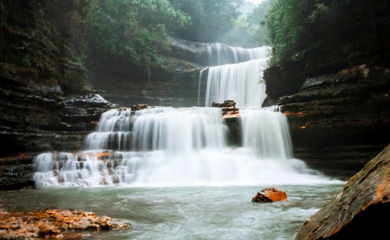
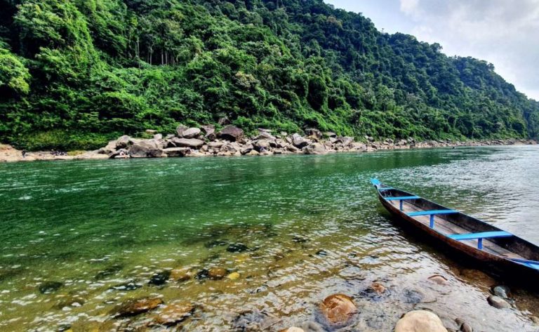
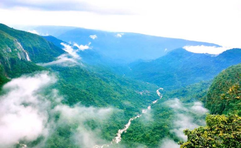
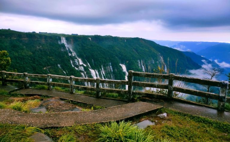
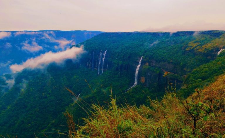
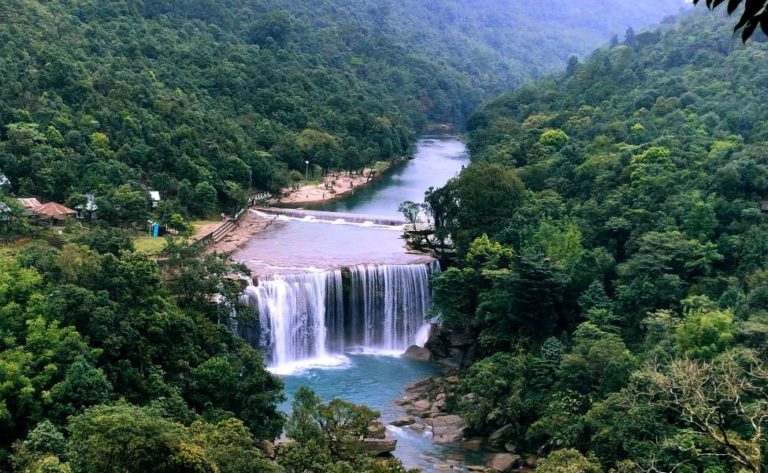
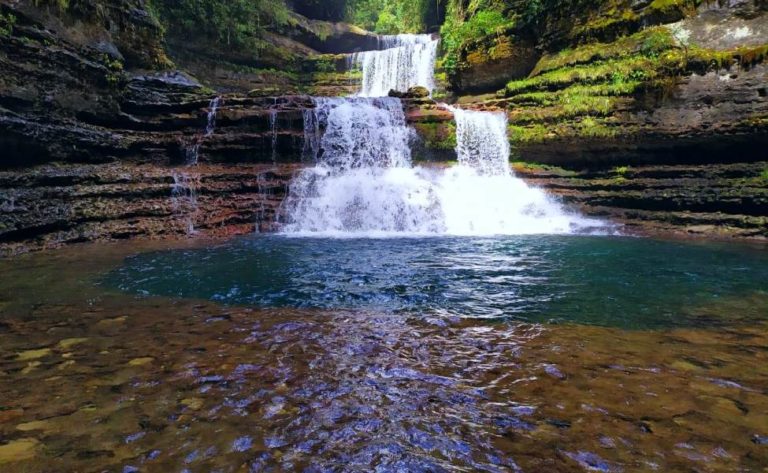
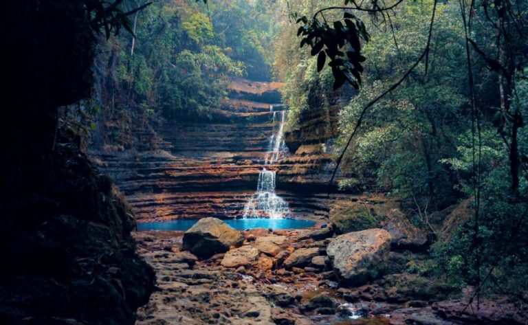
No other region of India has some of the most stunning and picturesque geographical riches as the North-Eastern regions of India do. All of the states have incredible greenery, biodiversity, and other environmental features that allow visitors to have a great time while they are here. Traveling to one of the North Eastern states could be a great option to escape the hectic and stressful way of life we’ve learned to live to in big cities. You must see each waterfall that we will cover in today’s blog post if you have plans to travel to the North East. Examine them and select one for your upcoming holiday. The Langshian Falls are discovered in Meghalaya’s west Khasi slope area, close to the township of Sangkuriang. Its distance from Nongstoin is about 24 kilometres, and its elevation is roughly 1106 feet. The Langshiang falls are created when rising torrents from the Kynshi canal combine with a few other tributary. You can decide to hike to the Nongkhnum stream island and climb all the way to the top to see a stunning panorama of the surroundings. The breathtaking beauty and thriving natural greenery of this amazing area will wow you once you achieve the summit, so it is definitely worth the trek. These streams in North East India are referred to as the Seven Sisters Waterfalls and are located in Mawsmai Village in the East Khasi Hills region. This is undoubtedly among Cherrapunji’s must-see locations. Jagged rocks, a sinister hillside, and a roaring waterfall will astound you with their beauty. These appear really ethereal and ageless, with 7 different falls dispersed across the mountains. Additionally, if it rains, if you’re fortunate enough, you’ll get to see the waterfall in its entirety. One of the must-see locations when travelling through India’s North Eastern region is Shillong. Elephanta Falls are without a doubt the most beautiful of the waterfalls in North East India. There is a reason why these falls, which are hidden away on the outskirts of Shillong, around 12 kilometres from the main city, are among the most popular waterfalls in North East India. The name “Ka Kshaid Lai Pateng Khohsiew,” which means “Three Step Waterfalls,” refers to the three distinct parts of this signal transduction pathway, where one area leads to the next with steps. Nuranang Falls, a hidden gem in Tawang, emanates from Sela Pass and is a lovely site to explore. The base is next to a small hydroelectric plant that produces power for local usage. The northern Sela Pass slopes are where the Nuranang River begins to flow. It empties into the Tawang river immediately below the cascade. A well-known urban legend holds that the Nuranang River and Nuranang Falls were named for a native Monpa girl nicknamed Nura who had aided Rifleman Jaswant Singh Rawat, recipient of the Maha Vir Chakra (posthumous) during the Sino-Indian War of 1962, before being captured by the Chinese. Jaswant’s heroic actions actually took place in less heroic conditions, and no woman would fit in there. The name Nuranang might have been given long before 1962. However, this waterfall is easily accessible from Bokakhat, a small town in Assam’s Golaghat district. The waterfall base is approximately 12 to 14 kilometres from Bokakhat, and a trek of approximately 04 kilometres will take you there. The interesting thing about this popular picnic spot is that you can always integrate or team up your travel plan while visiting Kaziranga National Park, which is a world heritage site. Planning a day excursion to the Kakochang Waterfalls while touring the Deoparbat ruins in Numaligarh is another option. Bokakhat and The distance between them is only about 23 kilometres. However, you cannot schedule both Kakochang and Kazirtnaga on the same day. It is so because the Kakochang trek requires at least a day to fully explore. Visitors to Kaziranga National Park can easily combine a visit to the Kakochang Waterfalls with a visit to the Deoparbat Ruins in Numaligarh.
MAJULI ISLAND
Majuli, the most ancient and densely populated riverine island in the world, is situated in the middle of the powerful and legendary male river Brahmaputra. It is clear that Majuli is a composite of several islands that originated and grew in the middle of the enormous Brahmaputra and its tributary, the Luit and Kherkatia, to the north, north-east, and north-western extremities. Because there aren’t enough credible evidence to back up the theories about Majuli’s history, it is exceedingly impossible to pinpoint the exact year or time frame of its establishment. However, it can be assumed that Majuli existed in the form of an island at approximately before the 13th century A.D., prior to Sukhapha’s arrival in the Brahmaputra valley in the year 1228, based on specific geographical evidences and literary descriptions. It was once called as “Majali,” and it was located between the Brahmaputra and the Dihing rivers. According to a different story, Naranarayana, the Koch king, sent his brother Chilarai to expand his domain into the upper Assam area. In his publication “The Majuli Island, Society, Economy and Culture,” Dr. D. Nath wrote that the Ahom emperor Sukhampha alias Khora Raja (1548–1563), who lost the war, gave homage and gifts to Koch king Naranarayana in the camp he had established at “Mojali” (Majuli). The highest elevation in Arunachal Pradesh is Gorichen Peak, which rises to an altitude of 6858 metres. The range of mountains in the Tawang Region, about 164 kilometres from the department’s administrative centre. Experienced climbers can ascend Gorichen Peak or Sa-Nga Phu, although amateurs or trainees can hike around the mountain’s perimeter. One of Tawang’s main tourist destinations, the summit is revered by the Monpa tribe who live there and think it would safeguard them from all misfortunes. The majority of visitors see Gorichen Hill while the route from Bomdila to Tawang. The whole Majuli land area escaped the attention of the colonisers due to the abundance of beels, wetlands, dormant river systems, and sparsely dispersed people. The majority of these were inhabited by animals and wild birds. According to land survey statistics from 1950, there were 1245.12 square kilometres of livable land overall. In Majuli, the population has unexpectedly increased by more than 1.35 lakhs over the decades after independence.
NATHULA PASS
The most popular tourist destination in Sikkim is the different altitudes pass known as Nathu la, which is located on the former silk road at the Indo-China boundary. Many travellers come here each year to take in the picturesque valley hike and the melodious waterfalls that can be heard as they go from Gangtok to Nathu la. Additionally, it provides a spectacular picture of the frost hills against the backdrop of a clear blue sky and winding, long roads. The stunning view of the mountain-protected Chumbi Valley in Tibet is provided by Nathu La.
GORICHEN PEAK
The highest elevation in Arunachal Pradesh is Gorichen Peak, which rises to an altitude of 6858 metres. The range of mountains in the Tawang Region, about 164 kilometres from the department’s administrative centre. Experienced climbers can ascend Gorichen Peak or Sa-Nga Phu, although amateurs or trainees can hike around the mountain’s perimeter. One of Tawang’s main tourist destinations, the summit is revered by the Monpa tribe who live there and think it would safeguard them from all misfortunes. The majority of visitors see Gorichen Hill while the route from Bomdila to Tawang.
RIVER RAFTING
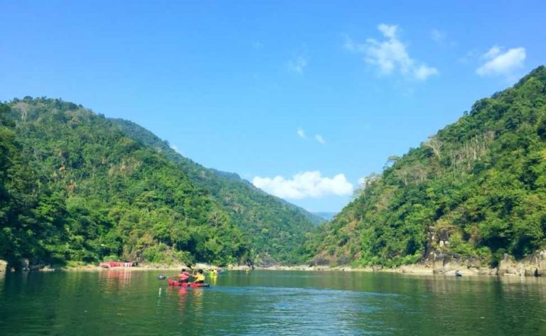
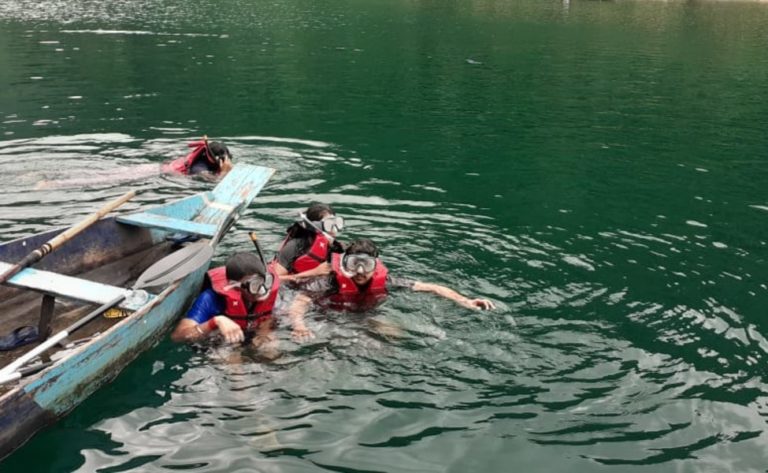
In Arunachal Pradesh, stream rafting is arguably perhaps the most thrilling adventure sports to partake in. The renowned Brahmaputra, Subansari, Lohit, and Siang rivers draw thrill-seekers from all over, enhancing Arunachal’s tourist attraction. It is clear that Arunachal is the perfect location for river rafting, both for the powerful rivers it is home to and for the province’s breathtaking beauty. One can see rich woodland, breathtaking scenery, and even magnificent tribal communities on both sides of the rivers. In Arunachal, there is little doubt that the powerful and irascible Brahmaputra River is the perfect for rafting.
KANCHENJUNGA
On the Indo-Nepal boundary in the Himalayas, at an elevation of 8586 meters above the sea level, sits Kanchenjunga, the third-highest mountain on the globe. It has five snow-capped majestic peaks, together known as the “Five Treasures of Great Snow.” It has five tall pinnacles that are each filled with grains, metal, silver, diamonds, and the almighty wealth from the sacred text. Kanchenjunga is made up of five ranges, with its three main peaks bordering Nepal’s Taplejung Province and the provinces of North Sikkim in middle and southern India. It lives among numerous threatened species of rhododendrons, orchids, and other plants. From Darjeeling and Gangtok, the vista of the magnificent Kanchenjunga range is just nothing short of magnificent.
SINGALILA NATIONAL PARK
Singalila National Park is a designated wilderness in the Singalila hill in the Darjeeling region of West Bengal, 36 kilometres from Darjeeling. It is the nation’s greatest park in West Bengal, located at a height of between 7900 and 12000 feet, and is a well-liked tourist destination in Darjeeling. The Singalila protrusion, which runs across the park and descends from Peak Kanchenjunga in the north and extends south to the northern edge of the Gangetic Plains, gave the park its title. The park forms the western boundary with Nepal and the northern border with Sikkim. Singalila National Park is renowned for its amazing stunning features and breathtaking views of Himalayan peaks in addition to its rich biodiversity. The park features some breathtaking hikes through wildflowers and alpine meadows. The most popular trekking location in Darjeeling is Sandakphu, the highest mountain in Singalila National Park. Another well-liked trekking location in Singalila is Phalut. Both locations have some stunning views of Mt. Everest as well as the surrounding Kanchenjunga snowy ranges.
KAMAKHYA TEMPLE
One of the earliest Hindu complexes in Guwahati, Assam, and the region is the Kamrup Kamakhya Temple, also known as the Kamakhya Temple. On the Nilachal hills sits the temple. It is considered one of the most treasured and ancient locations for Tantric rituals. It bears the name Kamakhya after the supreme deity. The Hindu Goddess Parvati requested that Lord Shiva construct a temple for her so that she might practise meditation in peace until she found the perfect husband for oneself, according to Sanatan Dharm, which is how the Kamakhya Temple came to be. The location of the annual Ambubachi Mela, which honours the Goddess’ menstrual cycles, was discovered.
KOHIMA MUSEUM
The Nagaland State Museum exhibits both of these components. Nagaland is an acreage of tribes and traditions. So this exhibition is the perfect place to visit if you want to see the unique assortment of tribal items. You can learn about the evolution of Naga tradition by going to the Nagaland State Museum. The World War II Museum is located in the Naga Heritage Village in Kisama. Countless artefacts, weapons, detailed maps, and depictions of the Battle of Kohima can be found in the well-maintained museum. It displays artefacts and old pictures including both Japanese soldiers and the British-Indian army. A segment is also devoted to the Indian National Army, which fought side by side the Japanese in an effort to drive the British out of India. you can view archival historical jeep shown during Hornbill festival.
UJJAYANTA PALACE
The metropolis of Agartala’s glittering white Ujjayanta House harkens back to the time of the Tripura Maharajas. Rabindranath Tagore, a Nobel Prize winner, gave the building the appellation Ujjayanta Palace. Experiencing antiquity and imperial elegance within the walls of Ujjayanta Palace is a solitary event. Maharaja Radha Kishore Manikya constructed this Indo-Saracenic residence in 1901 AD; it is situated on a lakeshore among sizable Mughal-style gardens. The palace features three 86-foot-tall domes, gorgeous tile flooring, arched hardwood ceilings, and exquisitely designed doors. Around the Palace are numerous temples. The nighttime floodlighting of this location increases its allure. Up until 2011, it served as the Assembly’s home. Currently, the State Museum is housed at the Royal Palace.
DIBRUGARH
Among the most significant tea trading hubs in India, Dibrugarh has excellent access to the Brahmaputra. This location is a must-see and a popular major tourist attraction in the state of Assam due to the relaxing vistas and entertaining activities. Trekking, climbing, camping, and other adventure sports are all available. In India, Dibrugarh is referred to as the “Tea City.” Now let’s talk about when to go to Dibrugarh. Dibrugarh may be visited in the wintertime, from October to March, when the weather is at its best. However, any season of year is an excellent opportunity to travel this Assamese city because, generally speaking, the state enjoys a pleasant temperature for exploring and wandering at any given moment.
KANGLA FORT
The Kangla Fort or Kangla House, which stands near to the shore of the Imphal River, is a representation of Manipur’s greatness. The Meetei or Manipuri name for “Kangla” is “desert land.” Many Meetei kings controlled Manipur from the fort that was formerly the old capital of the state, Kangla. This fort has been around since 33 AD, when Nongda Lairen Pakhangba, the legendary God-King of Manipur, first reigned. As they continued to dominate the area, succeeding rulers gradually improved and developed it. On the entrance of the palace, King Khagemba (1597–1652) commanded the construction of a brick wall. After that, Khunjaoba (1652–1666), his son, made great efforts to make the fort beautiful.
Frequently Asked Questions on Northeast
Not all states, though. However, three of the seven northeastern states—Arunachal Pradesh, Nagaland, and Mizoram—require a permit. This licence is known as an Inner Line Permit (ILP). Any Arunachal Bhawan, Nagaland Bhawan, or Mizoram Bhawan outside of northernmost can issue a permit. Domestic flights in the north, like the main terminal in Guwahati, have the ability to issue permits. The Arunachal Pradeshian government has also made it possible to apply for Inner Line Permits online. You will need a different kind of permit called a Protected Area Registration if you are a foreign national (PAP). Typically, we include the cost of ILP certification in the overall price of our travel packages.
You are going to require least 30 days to see all of Arunachal Pradesh’s attractions. The Tawang region may be explored in 9 days, including Bum La Pass and Zimithang. It will take a another 8 days to travel via the Ziro and Mechuka region (if you continue from Bhlukpong, after covering Tawang). If you proceed from Pasighat, it will take you an additional 5 or 6 days to travel via the Mayodia Pass and reach the Anini province (after covering Mechuka). It will take an additional 5 days from Pasighat to reach the Dong area through Tezu. It will take an additional 4 days to cover the Namdapha and Tengapani region from Dibrugarh. Take note that only standard sightseeing is included on these trips. It will require more time if you want to engage in specified tasks like birding in the Eaglenest Wildlife Sanctuary in the Bomdila region, researching spiritual Buddhism in the Tawang region, or engaging with native tribes from other regions.
You will need roughly 10 or 12 days to do safaris (and other activities) in the most well-known national parks in Assam. Additionally, Majuli, the largest river island in the world, requires two to three days to fully explore. It will take roughly 20 days to visit all of Assam’s notable locations, including its wildlife, culture, legacy, and tea-growing regions.
You would need roughly 10 days to visit all of Meghalaya’s stunning locations on foot.
The weather varies from region to region all across the northeast. The northeastern province’s topography is quite fluid. While it is relatively cold in Assam and Tripura’s plains during the winter, it snows in some of the high altitude regions in the Tawang and Mayodiya regions of Arunachal Pradesh. Meghalaya’s mountainous terrain experiences extreme cold during the winter, but snowfall has not yet been documented. The hilly regions of Nagaland, Manipur, and Mizoram experience chilly weather in the wintertime as well. On the other side, Assam and Tripura’s plains get quite hot throughout the summer. Meghalaya and the mountainous regions of Nagaland, Manipur, and Mizoram are pleasant. Summertime in Arunachal Pradesh is not very noticeable in the mountainous region.
Northeast India has a wide variety of food, both vegetarian and non-vegetarian. There is no shortage of menu options supplied by restaurants in the popular tourist destinations, despite the fact that the cuisine of some regions is unique from the others.
Mid-April marks the Bihu holiday in Assam. The second week of October is Tawang (Monpa) celebration time in Tawang, Arunachal Pradesh. The Hornbill celebration takes place in Kohima, Nagaland, during the second week of December.
The ideal locations for your weekend trip to Northeastern India are Shillong and Kaziranga. Other well-known locations will require more than a weekend to visit.
Numerous well-liked trekking locations may be found in Northeast India. These locations each provide a distinctive experience. Here are a few well-known trekking locations:
Sohra vs. Cherrapunji The Nongriat village region in Cherrapunji, Meghalaya, is the main trekking route and is home to the double decker live root bridge. The Rainbow Waterfalls, which are located along the same path as the live root bridge, are reachable by continuing your hike. This trek should take 5 hours to accomplish on average. The single decker root bridges of Umunoi and Umkar can also be reached after a quick hike of under two hours.
You can undoubtedly travel by yourself to the Northeast. Since we are unable to accommodate you in any other group if you are going alone, you will need to rent the complete car. We now only offer private tours with flexible dates.

